docc Posted January 19, 2021 Share Posted January 19, 2021 Pretty recently, @Cabernet started a thread about using the BeeLine for navigation. He made numerous great observations about motorcycle navigation, devices, and techniques. Lately, my riding buddies have been suggesting I update my maps. Shoot, they're only a year older than the bike I bought new! 1 Link to comment Share on other sites More sharing options...
Goofman Posted January 19, 2021 Share Posted January 19, 2021 I use Docc. 2 Link to comment Share on other sites More sharing options...
gstallons Posted January 19, 2021 Share Posted January 19, 2021 19 hours ago, docc said: Pretty recently, @Cabernet started a thread about using the BeeLine for navigation. He made numerous great observations about motorcycle navigation, devices, and techniques. Lately, my riding buddies have been suggesting I update my maps. Shoot, they're only a year older than the bike I bought new! My work vehicle ( 86 Suburban ) had a milk crate full of these for Il , Mo , Ky , Tn . & other states This was before I accepted the fact GPS was a beneficial tool . I used to be able to cross a county on back roads by dead reckoning . I have been able to invoke Daniel Boone " I can't say I was ever lost out in the wilderness , but I was once bewildered for about three days" when needed ! 1 Link to comment Share on other sites More sharing options...
docc Posted January 19, 2021 Author Share Posted January 19, 2021 I recall motorcycle navigating with a page from the DeLorme Atlas and Gazetteer in the tankbag window. It took a lot of focus and some considerable time with eyes away from the road. I still use the DeLorme as an intricate part of doing Sat-Nav route planning. Perhaps the biggest advantage to Sat-Nav is the dot that says, "You Are Here (Not Where You Thought You Were)." Link to comment Share on other sites More sharing options...
LowRyter Posted January 19, 2021 Share Posted January 19, 2021 Just curious Docc, how many of those Delorme maps do you have to purchase? I would hope you could load the info electronically because that looks like a lot to carry. There may not be room for underwear in those saddlebags other than the maps. Link to comment Share on other sites More sharing options...
docc Posted January 19, 2021 Author Share Posted January 19, 2021 I have a half dozen of these atlases of my surrounding states where I've done 95% of my riding. When I was navigating from the tankbag window, I would photocopy the needed sections in black&white and use color to highlight the route, turns, and distance between. For the roughly 40 mile radius around my house, I would tear out that page for the tankbag window. I have also made "route books;" a technique I learned from a UH-1 MediVac pilot I knew. These feature a detail map of the tricky or key turns with some distance indicators with a "distinctive" picture adjacent. (That pilot was known for his flight plan books using, er, attractive models in scant attire/ if any). I've done 200-250 mile routes that I largely memorize and have maybe six tricky junctions in the route book. The adjacent image helps me memorize the turn and keep it distinct from the others. Drawback is having to reposition the route book in the window after each noted turn. DeLorme has a long history with electronic navigation and was acquired by Garmin a few years ago. They still produce the atlases that overlay the roads onto the topography. They are still part of my electronic route building by offering a big-picture perspective of road selection through (and over) desirable terrain and along water courses while avoiding cities, towns and awkward intersections 1 Link to comment Share on other sites More sharing options...
LowRyter Posted January 19, 2021 Share Posted January 19, 2021 I think Delorme booke books would be the perfect resource to make a Beeline map. I just wish working those maps on my phone was as simple as a marker on paper. 1 Link to comment Share on other sites More sharing options...
docc Posted January 20, 2021 Author Share Posted January 20, 2021 5 hours ago, LowRyter said: I think Delorme booke books would be the perfect resource to make a Beeline map. I just wish working those maps on my phone was as simple as a marker on paper. Yeah, I know a talented software engineer that struggles with the smart phone navigation algorithms. They don't give a rat that you want your Guzzi to sing down that creekside next to the bluff, but really good at connecting us to those Cheetohs we suddenly crave . . . Link to comment Share on other sites More sharing options...
docc Posted January 20, 2021 Author Share Posted January 20, 2021 Best smart phone nav results for route building I have see so far is a combination of Kurviger and Scenic. Creative route building is time consuming and fraught with dead-ends (literally!) and surprise creek crossings. Link to comment Share on other sites More sharing options...
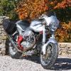
Rox Lemans Posted January 20, 2021 Share Posted January 20, 2021 Boring as it is I just use my phone. By the way, LOVE the Motogadget clocks.. 1 Link to comment Share on other sites More sharing options...
docc Posted January 20, 2021 Author Share Posted January 20, 2021 1 hour ago, Rox Lemans said: Boring as it is I just use my phone. By the way, LOVE the Motogadget clocks.. ?? Link to comment Share on other sites More sharing options...
Rox Lemans Posted January 20, 2021 Share Posted January 20, 2021 1 hour ago, docc said: ?? Aren't those clocks Motogadgets? Regardless.. Nice clocks.... 1 Link to comment Share on other sites More sharing options...
docc Posted January 20, 2021 Author Share Posted January 20, 2021 8 hours ago, Rox Lemans said: Aren't those clocks Motogadgets? Regardless.. Nice clocks.... Hey, thanks! They are Speedhut. I had a great time getting the faces custom made and doing the installation. I just could not bring myself to buy a fourth Veglia speedometer . . . 1 Link to comment Share on other sites More sharing options...
LowRyter Posted January 20, 2021 Share Posted January 20, 2021 17 hours ago, docc said: Best smart phone nav results for route building I have see so far is a combination of Kurviger and Scenic. Creative route building is time consuming and fraught with dead-ends (literally!) and surprise creek crossings. I gave Kurvgiver half an hour of my life that I'll never get back. I can almost get 90% of my intended route on Beeline in about an thirty minutes time that should take two minutes. 100% is out of the question. All I can say, build the route a step at a time, don't try to identify the final destination and then hope to alter the route to intended preferences. 1 Link to comment Share on other sites More sharing options...
Rox Lemans Posted January 20, 2021 Share Posted January 20, 2021 8 hours ago, docc said: Hey, thanks! They are Speedhut. I had a great time getting the faces custom made and doing the installation. I just could not bring myself to buy a fourth Veglia speedometer . . . That's what I meant.🤣 I actually bought a set and haven't installed them yet. Custom faces but are black. 1 Link to comment Share on other sites More sharing options...
Recommended Posts
Create an account or sign in to comment
You need to be a member in order to leave a comment
Create an account
Sign up for a new account in our community. It's easy!
Register a new accountSign in
Already have an account? Sign in here.
Sign In Now